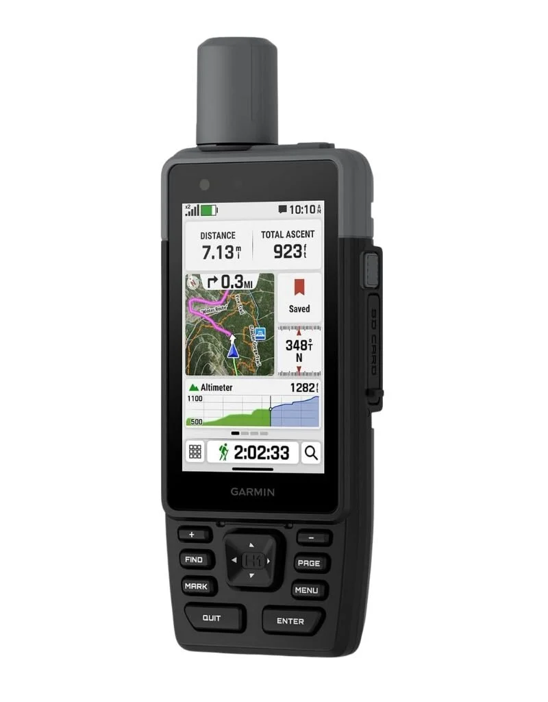
Garmin GPSMAP H1
Garmin
KES 75,000.00
Description
Rugged GPS handheld navigator boasts a sleek hybrid design offering a bright 3.5″ touchscreen that is sunlight readable, glove-friendly and has chemically strengthened glass to resist scratches; plus, physical buttons provide more versatility in any conditions
Navigate trails with ease by using preloaded TopoActive maps, downloadable high-resolution satellite imagery and the option to purchase an Outdoor Maps+ subscription for ongoing access to a variety of premium map content
Long battery life up to 145 hours in all Satellite Systems + Multi-band mode (assuming typical use with SatIQ technology)
Multi-band GPS and multi-GNSS support for superior positional accuracy and precise knowledge of where you are
Built to meet MIL-STD 810 for thermal, shock, water (IP67) and vibration to withstand weather and extreme temperatures
Compatible with the Garmin Explore smartphone app for seamless trip planning, locating geographic points and route-sharing capabilities
Use the built-in flashlight as a beacon to signal for help, or use as a torch to light your way when the path goes dark
Built-in siren can be activated to emit a loud alarm to help draw attention if you are in need
ABC sensors include an altimeter for elevation data, barometer to monitor weather and 3-axis electronic compass
Features an integrated Spine Mount 2 with included removable loop carabiner for more versaility on your adventure; compatible with additional Spine Mount 2 accessories (sold separately)
Navigate trails with ease by using preloaded TopoActive maps, downloadable high-resolution satellite imagery and the option to purchase an Outdoor Maps+ subscription for ongoing access to a variety of premium map content
Long battery life up to 145 hours in all Satellite Systems + Multi-band mode (assuming typical use with SatIQ technology)
Multi-band GPS and multi-GNSS support for superior positional accuracy and precise knowledge of where you are
Built to meet MIL-STD 810 for thermal, shock, water (IP67) and vibration to withstand weather and extreme temperatures
Compatible with the Garmin Explore smartphone app for seamless trip planning, locating geographic points and route-sharing capabilities
Use the built-in flashlight as a beacon to signal for help, or use as a torch to light your way when the path goes dark
Built-in siren can be activated to emit a loud alarm to help draw attention if you are in need
ABC sensors include an altimeter for elevation data, barometer to monitor weather and 3-axis electronic compass
Features an integrated Spine Mount 2 with included removable loop carabiner for more versaility on your adventure; compatible with additional Spine Mount 2 accessories (sold separately)
Specifications
- Display: Combines a sunlight-readable color touchscreen with physical tactile buttons for easy operation in wet weather or while wearing gloves.
- Design: Built to MIL-STD-810 standards for thermal, shock, and vibration resistance with an IP67 water rating.
- Multi-Band GNSS & SatIQ: Uses multi-band satellite technology (GPS, GLONASS, Galileo, BeiDou, QZSS) alongside SatIQ to automatically balance maximum location precision with battery efficiency.
- ABC Sensors: Includes an altimeter for elevation, a barometer to monitor atmospheric weather trends, and a 3-axis electronic compass.
- Maps & Imagery: Comes preloaded with routable TopoActive maps and supports downloadable high-resolution satellite imagery.
- Battery: Delivers up to 145 hours in satellite mode with SatIQ.
- Connectivity: Syncs with the Garmin Explore app for wireless track management, cloud backups, and trip planning.
- Emergency & Utility Features: Integrated LED flashlight (with beacon mode) and a high-decibel emergency siren.
- Warranty: 1-Year Limited Apple Warranty | Includes hardware repair coverage and technical support from iStore Kenya.